


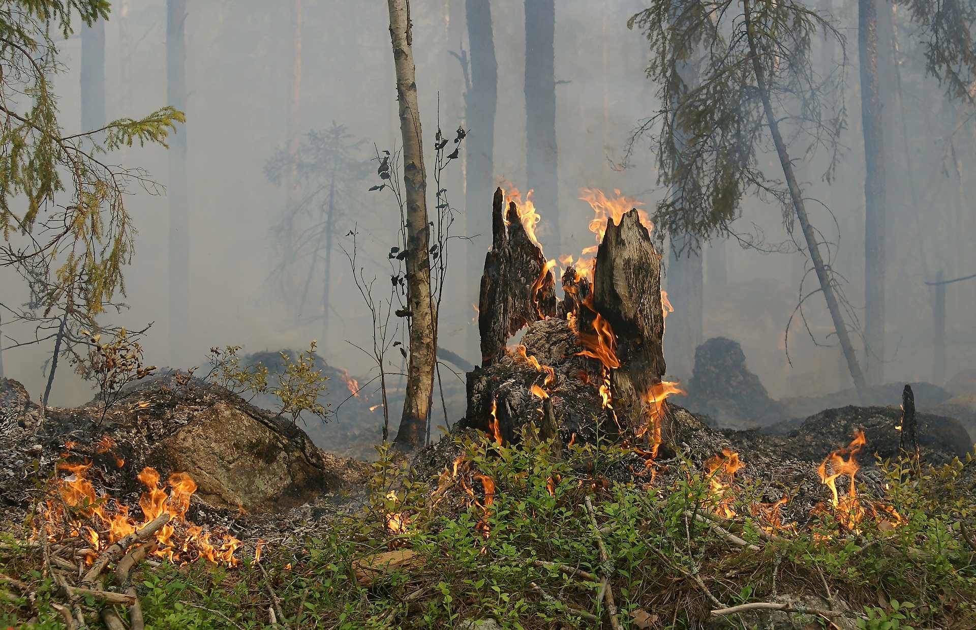
In addition to the sweltering heat wave gripping the South of Europe, wildfires are raging across the continent. Greece is battling multiple wildfires, the most severe in the Dervenochoria region north of Athens. In the town of Loutraki, 1200 children were evacuated from a summer camp as flames were nearing the site. Switzerland also finds itself fighting wildfires, as flames raged on the border with Italy. Wildfires are also blanketing the south of Canada as smoke clouds reached Europe.
- A sweltering heat wave and wildfires are affecting several countries in Europe, including Greece and Switzerland.
- Technologies like drone detection networks, forest sensors, satellite imagery with AI, innovative helicopters, and nano-satellites are being utilized to combat and prevent wildfires.
- These technologies provide early fire detection, real-time monitoring, and improved response capabilities to minimize damage.
Every summer, forest fires burn thousands of hectares of land in Europe, with the southern countries being the most affected. With arson still being a problem local governments struggle to tackle, hot temperatures can also favor fire breakouts. As summer temperatures are expected to soar in the years to come, the risk of wildfires will stay high. These technologies can help us out.
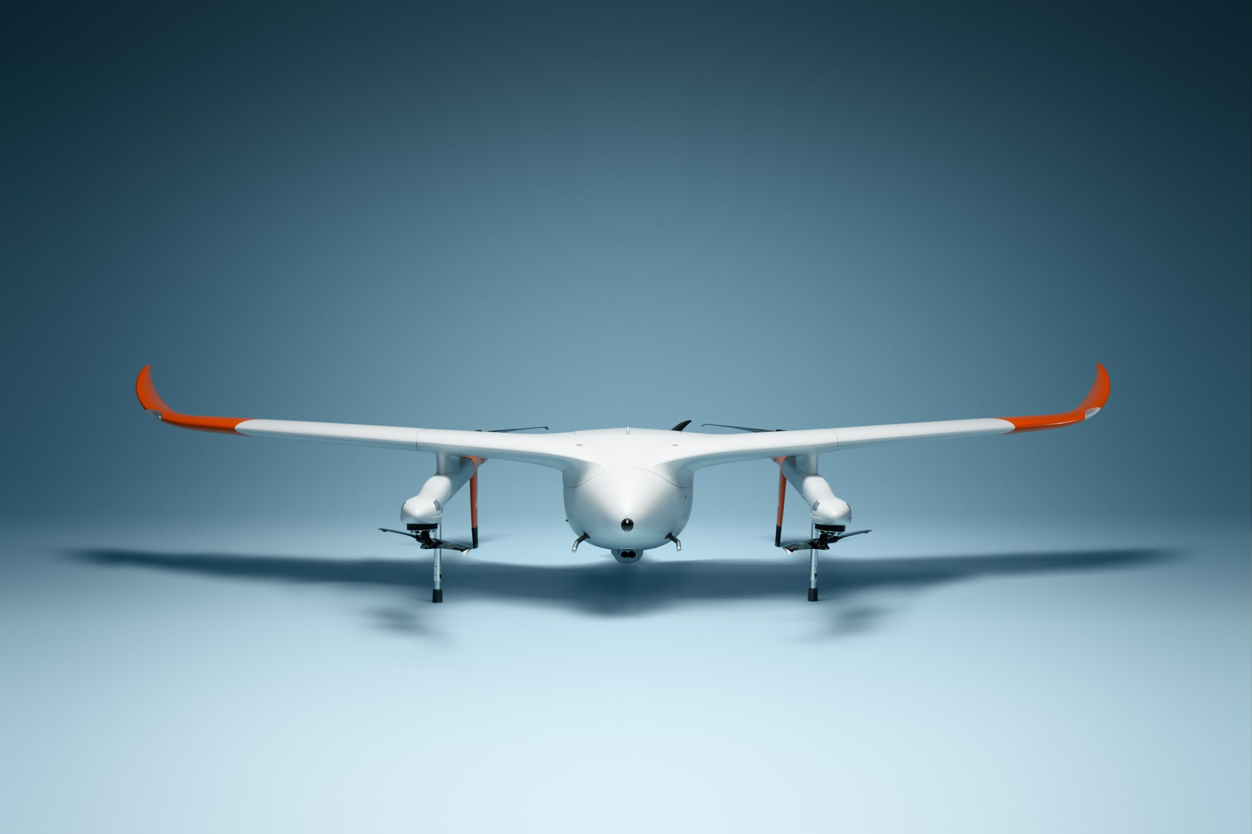
Drone detection
Among the many things drones can do, there is the one acting as a sentinel, alerting as a fire breakout happens. Dutch company Avy designed a drone response network that uses their Aera aircraft. These drones feature RGB and thermal cameras that can take snapshots of a given location, spotting several events, including wildfires.
As the response network gets an alert, an aircraft flies to the destination, taking pictures that can help accurately spot smoke columns. This information is of great value in the first stages of a fire emergency, as it allows better organize the firefighters’ rescue operations.
Forest sensors
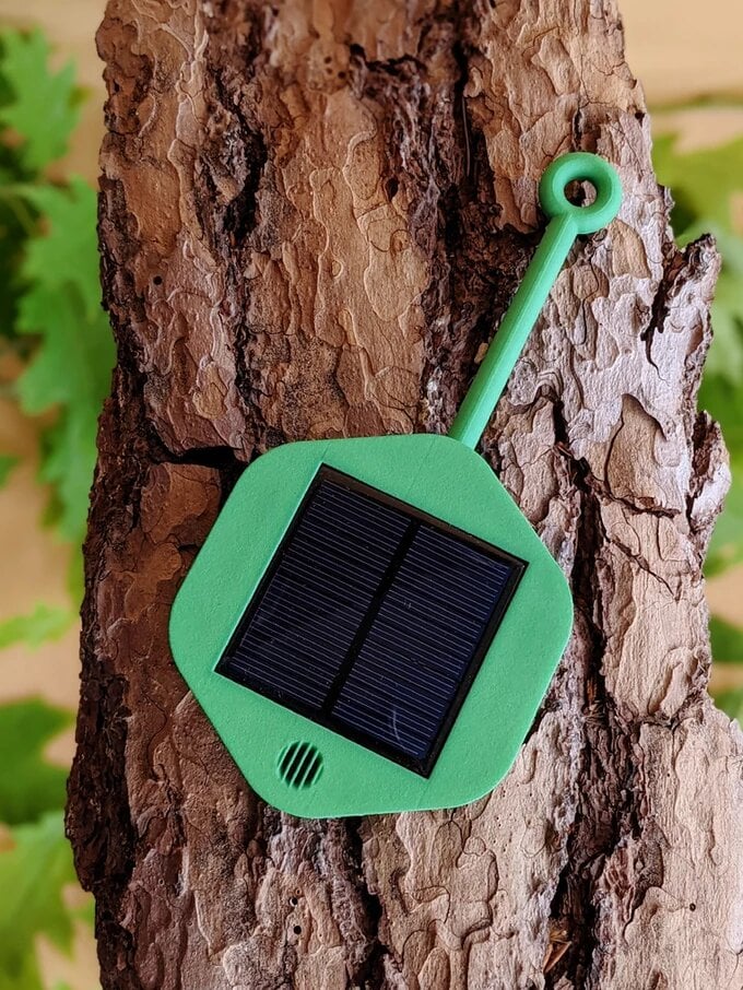
Drones can be great sentinels, but what about having smart guards in the middle of the woods? Dryad Networks developed Silvanet, a sensor system that monitors forests from the inside.
These small solar-powered sensors can collect real-time parameters such as temperature, humidity, and air pressure levels. Moreover, their embedded gas chip is the game changer. It can spot fire in the smoldering phase – right before it turns into an open fire. Therefore, forest managers, or rescue units, can be notified in advance, preventing flames from burning hundreds of hectares. Furthermore, Dryad’s sensors are smart enough to distinguish wildfires from other smoke sources, such as cars.
Satellite imagery and AI
Sometimes, things are better seen from afar. Well, the Earth’s orbit should be far enough. An AI challenge launched by Fruitpunch in collaboration with the European Space Agency – ESA, gathered a group of software engineers to use satellite images to develop AI algorithms to measure humanity’s impact on planet Earth.
Creating models to detect wildfires was part of the task, too. Satellites are equipped with powerful multispectral instruments that allow recording land surface temperature (LST). This same data is used for creating city heat maps tracking urban heat islands. At the same time, LST values help spot wildfires from space, getting accurate information on the flames’ extension, for instance.

Innovative helicopters
Preventing is good, but is there new technology that can improve the on-field response to fire? Yes, there is. Yearly, the German Aerospace Center (DLR) hosts a design competition, challenging scientists to develop innovative aircraft solutions. Last year’s edition was all about future firefighting planes.
A University of Stuttgart team’s INFERNO design claimed first place in the competition. Their concept plane is a combination helicopter featuring eight horizontal rotors for vertical take-off and landing. The aircraft is powered via hybrid-electric propulsion. In addition, the helicopter can approach water reservoirs that would be too small for conventional seaplanes.
Satellite intelligence
And we come back to space again. OroraTech’s nano-satellites provide a global thermal intelligence service. Their over 20 satellites provide real-time monitoring of the Earth’s temperature, allowing their customers to have awareness and control of the situation continuously.
In addition, their technology can quickly detect bush-size fires and trace precise fire perimeter locations. Additionally, the system estimates possible fire spread based on the available information sources. The sensor is already assisting the Quebec province, Canada in managing the ongoing fires.
To the rescue
Drones, satellites, and helicopters can make a good team in fighting fires. From preventing to extinguishing flames, they can all be key in minimizing damage and preserving forests amid rising wildfires risk.
Related Posts


