

That we are all emitting too many greenhouse gases is indisputable. How much exactly, that remains an estimate. But that is about to change. By 2027, Europe will have a super accurate “climate camera” called TANGO, which is being developed in the Netherlands. “With this, governments and companies can take targeted action to reduce their emissions,” says Anton Leemhuis, director of earth observation at TNO.
Why you need to know this:
To get a grip on climate change, we need to be able to visualize emissions in detail. TANGO makes that possible.
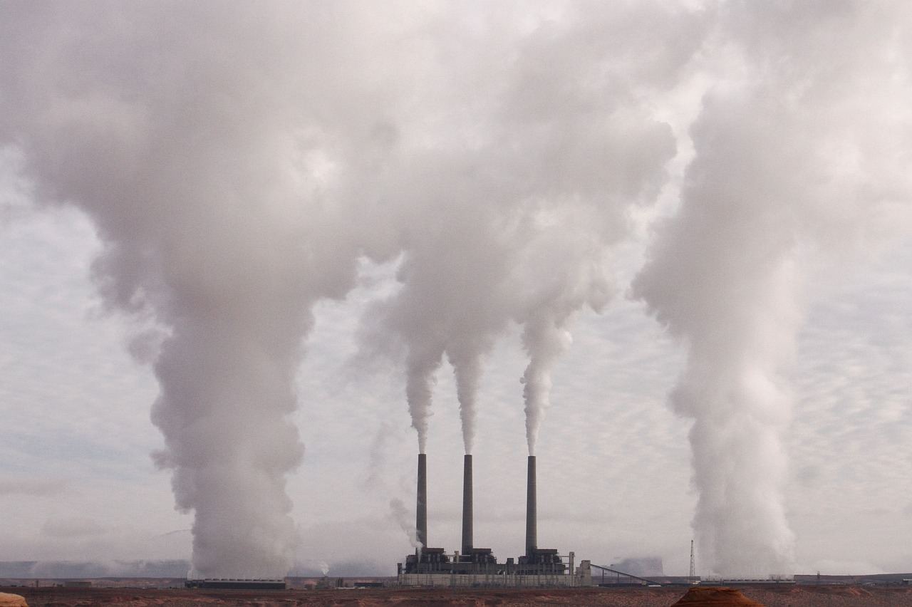
Climate satellites from Dutch soil will soon hold companies around the world accountable for their emissions. The European Space Agency (ESA) recently gave the green light for the realization of the TANGO satellites. These measure greenhouse gas emissions at source level from power plants, coal plants, garbage dumps and factories, among others.
The Dutch predecessor TROPOMI has already been tracking methane emissions worldwide since 2017 and can map about five percent of the sources. With TANGO, that percentage is expected to be increased to about 75 percent. In addition, TANGO will also measure CO₂ emissions. The satellites are being developed by Dutch parties such as TNO, ISISPACE, SRON and KNMI.

Measuring at the source level
Scientists increasingly understand where emissions come from. Yet there are still 101 questions that remain unanswered. For example, atmospheric methane concentrations are still rising, with no direct explanation. Possible causes are landfills, or melting permafrost in the north.
Anton Leemhuis is responsible for satellite development within TNO. “Most of the emissions are not measured right now. Instead, we make estimates. There is a lack of measured information about the amount of emissions from specific sectors within a country or which plants and companies contribute to them. That, when it is important to be able to take targeted action. With TANGO, we can measure emissions at source level.”
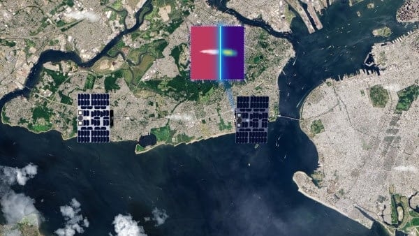
Viewed from space, the Netherlands is just a tiny dot on the globe. Until now, it was not possible to zoom in far enough and map countries’ emissions in detail. With the satellites, it can. “With TANGO we can map emissions around large sources, such as oil and gas installations and large power plants, think of steel plants like Tata Steel and the Botlek where a lot of industry is located. These sources also become well visible.”
Supporting decisions
Scientists benefit from the satellites for their climate research. In addition, governments can make important decisions, such as where to buy natural gas. Do we consider getting it from the Middle East, or do we go to America, where we know there are fewer emissions during the process?
But satellites are also relevant at the corporate level. Companies face increasing international laws and regulations as a result of the Paris Agreement, requiring them to comply with stricter emissions guidelines. To do this, they need detailed information about their own and their sector’s emissions. Says Leemhuis, “Increasingly, companies want to know how they are doing compared to their competitors, partly because shareholders insist on it.”
Netherlands as a pioneer
The Netherlands has occupied a leading position when it comes to climate monitoring from space for some 40 years. It is therefore not surprising that our country in particular is going to develop the climate camera, Leemhuis said. “Among other things, we have built up a strong reputation in the field of optical manufacturing. Think of ASML, which is a leading global player in this field. In addition, we have a lot of knowledge diffusely spread around the country, think of SRON, the universities in Amsterdam and Wageningen, or KNMI and TNO.” In the past, the Netherlands was fully involved in previous satellite missions, such as GOME (Global Ozone Monitoring Experiment).
Preparations
Currently, the Dutch parties are busy preparing for the mission. As with any major space project, the team faces challenges. After all, it requires considerable precision and expertise to integrate an instrument into a satellite, launch it successfully and also make it function properly at an altitude of about five hundred kilometers. Leemhuis: “With such complex space projects, it always remains to be seen whether everything will succeed on time and within budget, but here also lies an important asset of our consortium: we have worked together many times before and have extensive experience in building satellite instruments. The project depends on suppliers from abroad. This is exciting, especially in times of raw material scarcity. For example, we will need aluminum parts and electronics in the coming years.”
Still, the director does not foresee insurmountable problems. “Over the past three years we have scrutinized, built and tested all the critical components. That is also one of the reasons why ESA said: we are going for it. It’s an ambitious mission, but we’re going to make it happen.”
Related Posts


