


Researchers from the Technical University of Denmark (DTU) and ONERA are testing a quantum accelerometer as part of the Green Quantum project. This technology could revolutionise high-precision air navigation and provide a solution for GPS jamming crisis situations, says DTU in a press release.
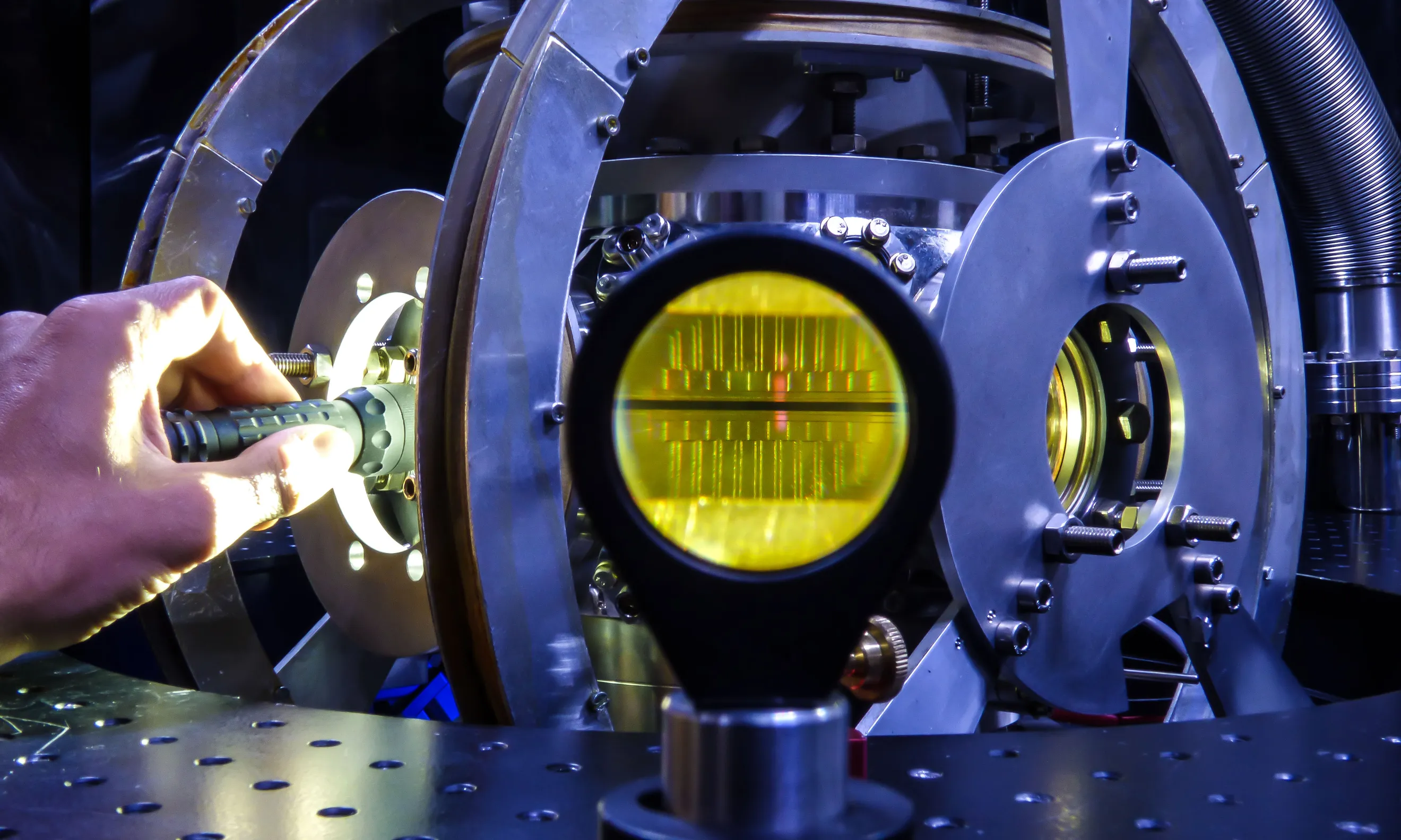
The quantum sensor uses cooled rubidium atoms in a vacuum container to register Earth’s gravity and aircraft accelerations with a laser. The project aims to reduce the current large equipment into a sensor-based chip technology the size of a coffee cup. Applications of this technology include climate change monitoring and geodynamic studies, as well as navigation in buildings, underground, and submarines.
- A new quantum technology could revolutionise air navigation
- Quantum accelerometers could also enable precise satellite measurements of climate change, ice melting, global sea level rises, and flooding
From Smartphone Accelerometers to Quantum Sensors
The quantum sensor being tested by DTU and ONERA researchers is similar in concept to the accelerometers found in smartphones, but its capabilities are far superior. The sensor utilises rubidium atoms cooled to near absolute zero inside a vacuum container. As the aircraft moves, these atoms reflect Earth’s gravity and the accelerations of the aircraft, which are then registered using a laser.
Currently in the early stages of development, the equipment required for the quantum sensor is bulky, weighing hundreds of kilos and incorporating electronics, lasers, and vacuum equipment. However, the ultimate goal of the ADEQUADE project, funded by the European Defence Fund (EDF), is to miniaturise this technology to the size of a coffee cup. ADEQUADE is a collaboration between 35 European partners, including DTU Space and ONERA.
Testing in Iceland
DTU and ONERA have previously collaborated on testing the quantum accelerometer in Iceland and the Bay of Biscay between 2017 and 2019. DTU was the first to demonstrate quantum sensors for measuring Earth’s gravitational field variations from an aircraft, a technique known as quantum gravimetry. Quantum gravimetry has applications in climate change monitoring and geodynamic studies, such as in volcanic or earthquake zones.
Greenland Test Flights
In the Greenland test flights, DTU researchers and PhD students have installed the quantum sensor in a gyro-stabilised bed, ensuring it remains constantly horizontal. Precise GPS measurements are used to correct the quantum measurements for the aircraft’s movements. A commercial air navigation unit provides an overview of the aircraft’s position within a few centimetres of accuracy, enabling the determination of the gravitational field with high accuracy (10-6 g). The data collected will be used to improve Greenland’s GPS-based altitude measurements and quantum navigation correction.
Selected stretches of the test flights are flown without the use of normal navigation systems, relying solely on the quantum sensor for guidance. Data is collected to assess the precision of quantum navigation in relation to the gravitational map and the aircraft’s movements. Improved gravity maps are crucial for the full utilisation of quantum sensors in precise navigation.
Quantum Navigation: Beyond GPS
The current quantum sensor relies on a single laser source to register the upward and downward movements of atoms. By incorporating multiple lasers, it could become possible to make an aircraft controllable solely by the quantum sensor, independent of GPS systems that are vulnerable to jamming or spoofing. This could open up potential applications for the quantum navigation technology in buildings, underground environments, and even submarines.
Quantum accelerometers could also enable precise satellite measurements of climate change, ice melting, global sea level rises, and flooding, by detecting changes in the gravitational field. DTU is actively participating in the parallel EU project CARIOQA to prepare for future European quantum satellite mission technology.
Related Posts


