

About Mountain Maps
- Founders: Denny Calovi, Mattia Fravezzi, Renato Nerini, Paolo Rota, Antonio Sciarretta
- Founded in: 2021
- Employees: 7
- Money raised: €120.000
- Ultimate goal: Making mountains enjoyable and accessible to everyone.
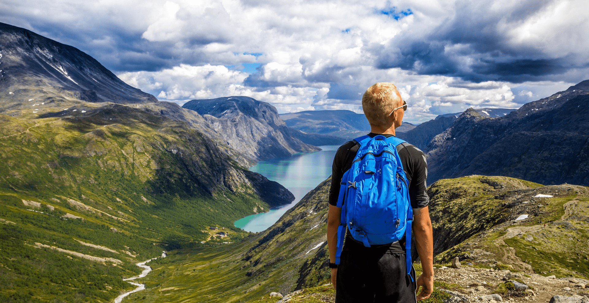
“Whenever my friends wanted to visit me – I live in Trentino Alto Adige, Italy – I used to spend hours checking all the mountain routes to hike. I did not want to make a fool out of myself. I realized that for moving everywhere else I had Google Maps, whereas there was not such a thing for hiking or skiing in the mountains,” recalls Denny Calovi, CEO of Mountain Maps.
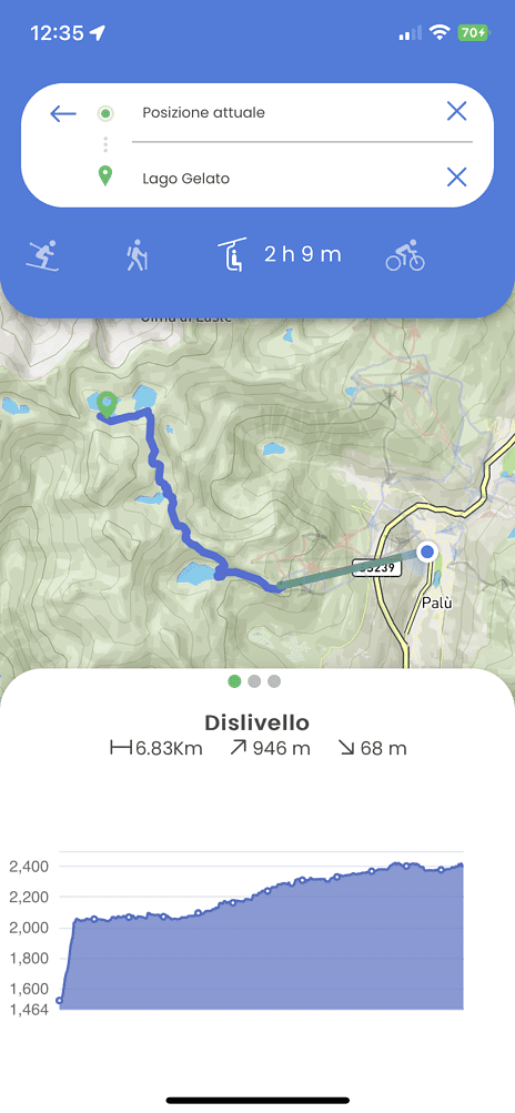
The start-up, born and bred on the slopes of the Italian Dolomites, developed an app to improve everyone’s experience on the mountains. The software allows users to create personalized routes – using artificial intelligence algorithms – and provides guided navigation during the journey. This helps reduce the number of people who get lost on paths they have never walked before. According to Mountain Maps’ research, one out of every two visitors gets lost in the mountains, and one out of every three is unsure which route to take. In this installment of the start-up of the day series, Calovi explains how his company makes a trip to the mountains more enjoyable for everyone.
After realizing that such an app was missing, what happened next?
“I brooded about the idea of creating a new app for a while. Then, I gathered all the other team members, thereby kick-starting the process of creating the start-up. We validated our idea, noticing how the problem existed and mostly affected non-expert visitors.”
What features does the app have?
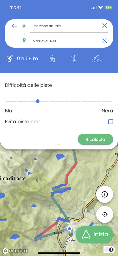
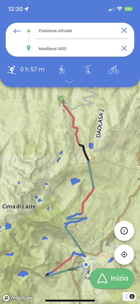
“First of all, the app is free and fully works offline. At the moment, the app has three use modes: skiing, hiking, and hiking with chair lifts. During the summer we will release a mode for cyclists too. Regarding the ski mode, it is possible to filter ski slopes depending on their classification – blue, red, and black whenever applicable. In the upcoming spring, we will add more filters to the hiking mode as well – such as access with a stroller, ground type, and the possibility to filter out the via ferrata routes.
Furthermore, the app now features two kinds of maps, one for the winter season and one for the summer. The former gives more relevance to ski slopes and ski lifts, while the latter presents more hiking paths. Maps cover all Italian skiing destinations. Austrian, French, and Swiss maps will be available soon as well.”
How does the app customize the experience of every user?
“We collect users’ data, such as what routes they select, and how much time it takes them to complete them. We will gather data such as age and gear, to improve route customization, and launch an index to classify routes by their difficulty level. All this data helps to suggest users the best routes depending on their previous ones.”
How can tourism organizations benefit from the app?
“We already work with some partner destinations that help us promote our app. Based on the data we collect, they can create tourist offers that suit all kinds of visitors better. Additionally, these organizations can promote specific events and places.”
What further features are you going to implement?
“Another feature we plan to introduce is the possibility to plan a route via the app and save it for later. In the future, we plan to release a premium version of the app, with additional features such as ski lift line avoidance.
Will you also include an emergency button?
“We are in talks with Trentino’s rescue organizations, to understand how to implement it. It is a sensitive topic because it needs to be used in the event of emergencies only. One way to do it could be to make it available within some areas, but we are still working on it.”
What is next for Mountain Maps?
“Within the next six months, we expect to complete our first round of funding. By the end of the summer, we aim to strike new partnership deals and to reach a threshold of ten agreements. This would help both to promote the app and further validate our model. The goal is to be present across all of the Alps in a couple of years.”
In your opinion, what will be the key to your growth in the next few years?
“As a company, we firmly believe in the idea of establishing partnerships with tourist destinations. Most importantly, we believe that there is no other tool that can solve the problem like we do. The average tourist looks for simple route information so they can enjoy the mountains in particular.”
Related Posts


