
Fast action is what counts during rescue operations. Only then can it be guaranteed that casualties can be quickly found and cared for. Therefore, every time a rescue operation is carried out, helpers have to obtain a precise picture of the situation within the shortest possible time. A new system can support them in this in the future.
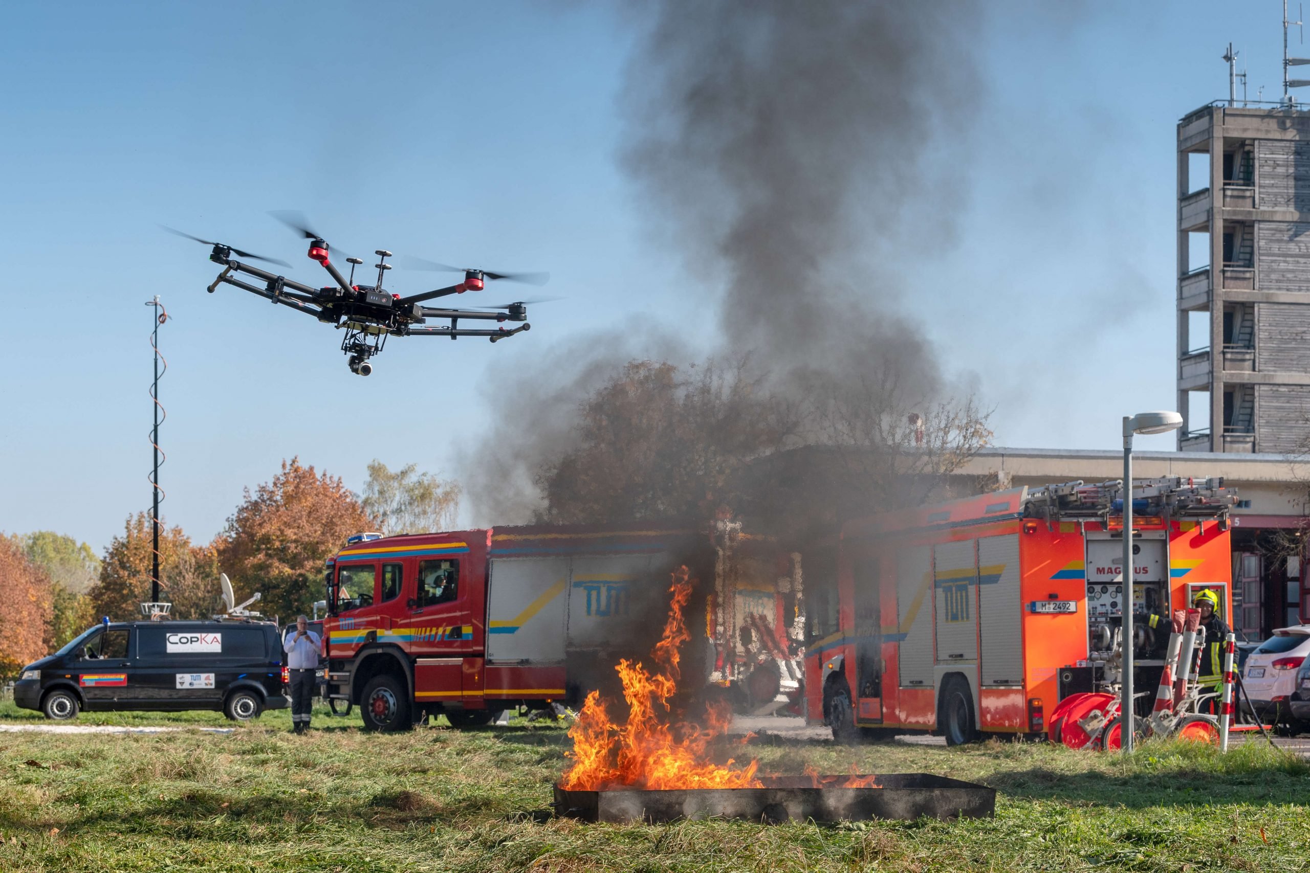
Under the name of CopKa, scientists of the Technical University Munich and partners have developed a system for rescue forces. The core of the system is a multicopter which will fly over the area of operation. The drone with fixed rotors takes pictures in the air. In this way, additional information can be collected from the scene of the mission. The rescue forces thus gain an overview of the entire operational area within a short period of time. Injured persons can be found quickly because they are not always clearly visible from a ground perspective. For example, if they lie behind a vehicle or embankment.
Cooperation with the fire brigade
For the CopKa project, the scientists worked together with the TUM plant fire brigade in Garching. “It is particularly difficult to get a complete picture of the situation quickly in very large areas of operation,” explains Michael Reffgen from the TUM plant fire brigade in Garching.
A particular challenge during rescue operations is the transmission of pictures and videos to the emergency services. This requires a lot of data volume. In theory, mobile phone networks could be used for the transmission. “However, the networks are often used to full capacity, especially in the event of an accident or fire, because everyone there naturally tries to reach their relatives,” explains Sabine Letschnik from the Institute of Astronautics. In addition, gaffers also block the mobile phone networks and, in the worst case, even the rescue services at the scene. The scientists, therefore, use a satellite link for data transmission. The advantage is that the data volume made available via this link does not have to be shared. The data can be transmitted to any location via a secure connection. For example, when a hazardous goods transporter has an accident and pictures are to be sent to an expert abroad.
No extra employees required
Since the Multicopter can also be controlled from the control centre, no one from the rescue team has to be given that task. Only the satellite dish has to be aligned quickly and automatically with the satellite. To achieve this, the researchers rely on position sensors. However, they have to adapt to local conditions. To prevent reception from being disturbed by large buildings, for example, the satellite dish could be used to position the vehicle on a slope at an angle.
First phase of the project completed
For three years now, the TUM researchers and the partners of the plant fire brigade have been working on the CopKa project. The first phase concluded a major exercise. Here it was demonstrated how the system works. In phase two, the system is now to be further improved. The aim is for the Multicopter to take off on its own and fly off to the scene of action. This should make it possible to identify obstacles. In the future, each fire engine of the fire brigade could be equipped with a copter, a terminal and a small satellite dish.
Behind the name CopKa are the abbreviated terms Copter and Ka-Band-Satcom-Links. The TU Munich, the company IMST GmbH with the project partners LSE Space GmbH and TV1 GmbH are involved in the research project. It is funded by the Federal Ministry of Economics and Energy (BMWi). The German Aerospace Center e.V. (DLR) Space Management / Satellite Communication Division is the project executing agency.
Photo: A. Heddergott / TUM
Related Posts


