
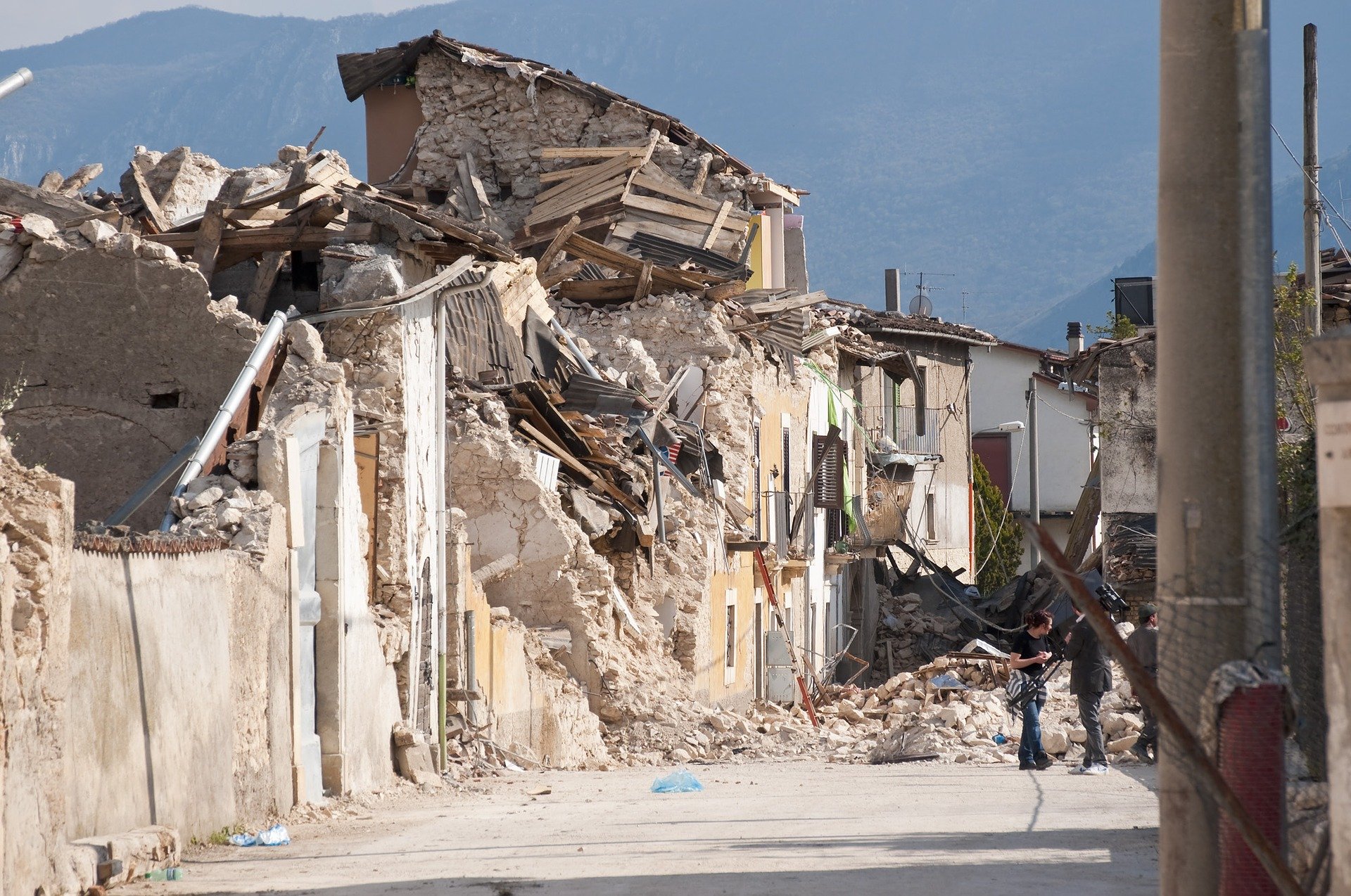

Turkey and Syria have been hit by a massive earthquake. At least 900 people died and thousands were injured. And that number is likely to rise even further; Many people are under the rubble. Earthquakes occur more often in Turkey. The country lies on geological fault lines. Two tectonic plates are adjacent to each other.
Worldwide, there are 8000 earthquakes every day. Most are caused by movements of the earth’s crust, but meteorite impacts, nuclear explosions, mining or gas extraction can also cause an earthquake. Innovative technology – such as sensors and artificial intelligence – can help to better predict earthquakes, detect victims and determine damage to buildings and roads. In recent years, Innovation Origins has focused on various types of tech solutions. We’ve listed the most promising ones for you.
Early warning
First of all, it is very important to see an earthquake coming, because it can save lives. Researchers from University College London and the European Center for Training and Research in Earthquake Engineering (EUCENTRE) are working on an early warning system for earthquakes. In various places in Europe, a warning can be given up to more than 10 seconds before an earthquake. For example, people can protect themselves through commonly recommended “drop, cover and hold on” actions. It also offers the opportunity to quickly leave a dangerous building or to find a safer place in a building.
The system consists of sensor networks and mathematical models to detect earthquakes in real time. “The key component is a dense network of sensors with a fast and robust communications infrastructure. Thanks to technological advances, it is now possible to install many low-cost seismic sensors and to upgrade existing sensors cheaply,” says researcher Elisa Zuccolo (EUCENTRE).

Locate the epicenter
Not only the initial earthquake, but also the aftershocks are dangerous. But the evaluation of the seismograms is traditionally done manually. This is not only time-consuming, it also depends on the subjectivity of the seismologist. Researchers at the Karlsruhe Institute of Technology (KIT) have now found a way to precisely locate earthquake epicenters using artificial intelligence. This makes it easier to predict aftershocks, which sometimes cause more damage than the first earthquake. Physical processes are also mapped out more accurately.
The researchers used a neural network to determine the time of arrival of seismic waves. They trained the network with a relatively small dataset of 411 earthquakes in northern Chile and were able to make predictions at least as accurate as the manual measurement of an experienced seismologist – and much more accurate than previous algorithms.

Helping people buried under rubble
After earthquakes or gas explosions, it often takes a long time to locate and rescue people buried under the rubble. To enable rescue teams to obtain better and more accurate information about the situation on the ground more quickly in the future, international scientists are now developing a modular sensor system for a drone, within the research project “Sensor Systems for Localizing Buried Persons in Collapsed Buildings” (SORTIE).
Four different sensor packages can be connected to the drone. These include a ‘bioradar’ to detect the breathing movements of buried victims, ‘mobile phone location’, ‘laser gas measurement’ for the remote detection of explosive air mixtures and ‘debris structure analysis’ to assess the stability of debris.

Mapping damage to buildings
After an earthquake, it is important to also map out damage to buildings. Two entrepreneurs from Groningen founded the StabiAlert company in the Groningen earthquake area. They developed a digital sensor, among other things. Founder Arjen Miedema: “It can measure a crack remotely for years, in 3D. A number of magnetic sensor elements are placed above a magnet and, using mathematical algorithms, three vectors are calculated that show the 3D motion of a crack. The sensor data is sent to an app once an hour. Through the app you can track if there has been any change and set alarm triggers to receive alerts.”

Related Posts


