

The ten-kilometer stretch of forest road on Finland’s E8 highway is known as the “Snowbox” because of the environmental conditions and has been specially equipped for tests with autonomous vehicles. Along the road there are cameras, “laser radar” lidar, ultra-wideband antennas and reflective panels. It is also underlaid with power and fiber optic cables and equipped with pressure sensors that detect both the condition of the road surface and the speed and type of vehicles traveling on it.
This road was chosen to set up the Snowbox infrastructure because, despite its remote location, it is also economically important because trucks use it to travel south from Arctic fisheries.
If you can drive there, you can drive anywhere
“If autonomous vehicles can drive well here, they can drive almost anywhere,” says Sarang Thombre of the Finnish Geospatial Research Institute, which is leading the Arctic PNT project. “Our project was mainly aimed at making sure that the precise positioning required by autonomous systems is available here to determine whether this test site is indeed a place that driverless vehicle manufacturers should use for testing. We’ve conducted experiments with a robotic car for two consecutive seasons to show that the precise positioning required is possible to within 20 cm.”
Snowbox is also connected to the FinnRef network of satellite navigation reference stations for this purpose to provide corrections for precise satellite navigation positioning. This reference data serves as a standard through continuous position measurements at fixed locations. This also allows measurement errors to be identified to increase position accuracy on a local basis.
“The Arctic is a challenging environment for autonomous driving in general,” Dr. Thombre points out. “Signal interference from the ionosphere, the electrically charged layer of the atmosphere, degrades satellite navigation performance. This effect is more pronounced in the Arctic region. And satnav augmentation systems also face challenges.” Because their signals are broadcast from geostationary satellites, they can only be seen up to 10 degrees above the horizon in the Arctic, he said. “And cellular coverage, useful for providing correction data from reference networks, is also inconsistent.”

Add to that the possibility of fog, snowstorms and rainfall, which make it difficult for cameras and lidar to work. Additionally, wheel speed sensors may also slip due to ice and snow on the road. Last but not least, temperatures that can drop to below -30°C can also affect the performance of electronics.
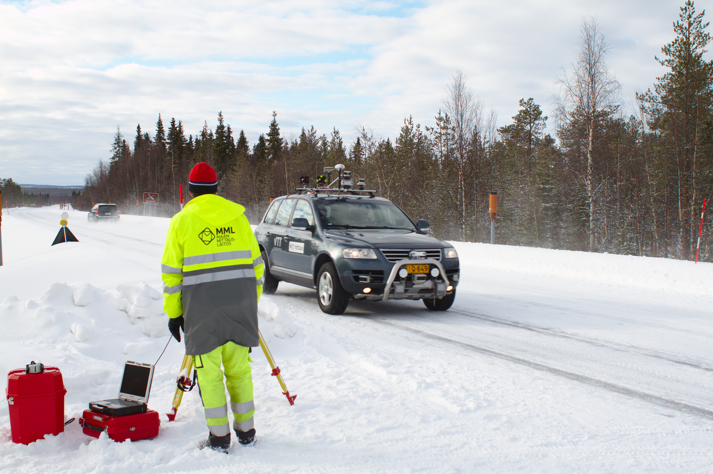
Data, data, data
“Martti,” the robotic vehicle the Arctic PNT team used for testing, was provided by the VTT Technical Research Center in Finland and is equipped with plenty of sensors and recording devices. Martti could have driven completely autonomously, Dr. Thombre explains, but they still controlled the vehicle manually. “We used it to collect all the data we needed. At the beginning, we used only satellite navigation – including Europe’s Galileo and EGNOS – and gradually added more and more augmentation data, including in-vehicle sensors and corrections from the FinnRef stations, to reach the important precision threshold of 20 cm for positioning.”
To retrieve FinnRef corrections from vehicle systems, various mobile SIM cards were tested. And, “As an additional challenge, we crossed an international border because part of the prepared E8 highway is on the Norwegian side – called Borealis.”
The Arctic PNT test runs from 2018 have given the Snowbox a “positive report card,” stresses the ESA, which supports the test runs through strategic initiatives for the Arctic region. “ESA’s Navigation Innovation and Support Program (NAVISP) – the development of new future positioning, navigation and timing technologies and services – now provides the opportunity for industry and national institutions to launch similar initiatives.”
Related Posts


